


Its also true that maps give a partial view particularly because until the 2nd Aswan Dam the Nile wrecked a lot of havoc and changed the shape of the banks and islands.
The older maps suggest there was little physical and human development until after the 1920’s – particularly on the west bank - either in terms of the city, villages or agriculture – but its hard to be certain. In general for the period prior to about 1900 there are more photographs than maps and I have used the former to try to develop a picture of the natural and man-made structures of that period. After 1900 western maps become more frequent which is odd because in the classical Muslim period cartography was a stand-out achievement – but maybe not in backward Egypt.
I imagine there are a few on this forum who have been long term residents of Luxor who will have more information on these issues, recollections and maybe better maps/photos. Please feel free to contribute.
The post is long, boring and detailed – so be warned. Some may want to read a 5 liner.
Here is what I think I have been able to work out:
Ancient maps exist but don’t provide very reliable information. Old western maps until quite recently were very imprecise – particularly on detail and it’s the Great Captain Cook who after 1770 brings his mind to French Enlightenment (a foreign disease) precision to naval maps/cartography. He was a failure and got no Imperial Orders or Admiralships that heroic and brave Royals now get. Justice for the best. Napoleon did maps of the Luxor area but the Government of France hasn’t put them on-line and what I’ve seen are imprecise.
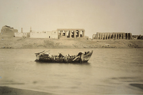
Whatever the maps say the early photography shows that the Nile was wide – at least for some of the year. Here is a photo from 1853-54 by the American/French John Beasley Greene, an archaeologist, taken from the East Bank, probably near the Luxor Temple, showing the then Ghezireh Island in the middle ground and the western hills beyond. At this stage there was another branch of the Nile on the west side of that island/another branch for part of the year.

(part of a small collection of historic ME photos sold recently in London)
As most know the Nile levels once varied wildly but I was surprised to see this Luxor river bank photographed by Beato from 1859 (I’m not too sure of the date) near the Luxor Temple.

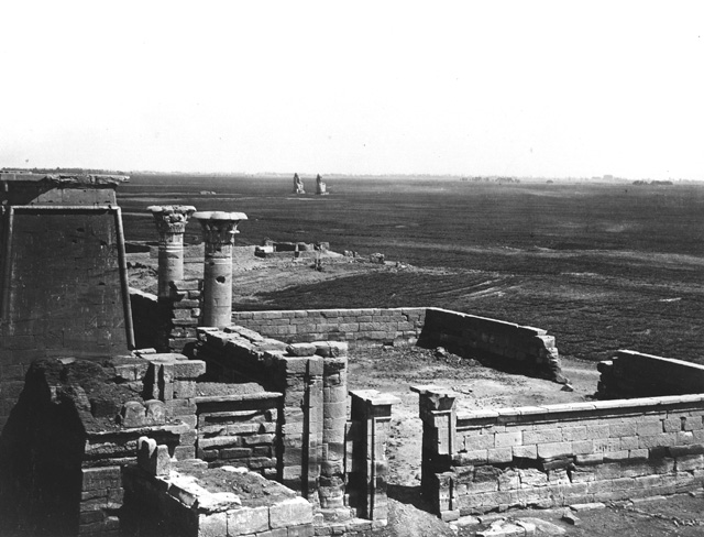
There wasn’t a lot happening on the west bank nor much evidence of human habitation – here is a photo by Frith from 1856-60 looking towards the Nile from Habu with the Colossi in the middle ground:
This is consistent with a much earlier litho from 1803 by Vivant Denon which shows little permanent human habitation in this area:
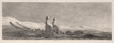
Its probable that in part of whole this plain was flooded for part of the year to produce one crop but preventing permanent structures.
Another photo by Beato of Memnon probably from around 1870 suggests that the area around the Colossi was not farmed or irrigated on any permanent basis:

But another one taken by the US photographer Eliot Elisofon shows that as late as around 1942 Nile flooding (unclear whether this was a standard or exceptional flood year) of the same area was extreme which suggests that the area might have been dry and barren for some of the year but flooding would have given them at least one crop (but there is little visible evidence of tilling):

This flooding might explain why housing, and presumably a permanent population, on the West Bank might have been sparse. It also raises questions (which I can’t answer) about the road and rail infrastructure on the West Bank which was developed over the next 70 years (see below). For example there appears to have been a detailed network of probably narrow gauge rail to deal with the sugar cane which, I think, was a major crop before WW2. This photo makes you realize how limited the control the 1st Aswan Dam (finished 1902) gave over Nile flooding and how necessary the 2nd one was to create permanent farming land.
A photo from circa 1870, which I think is of the half covered Luxor Temple, shows little modern development on the East Bank:

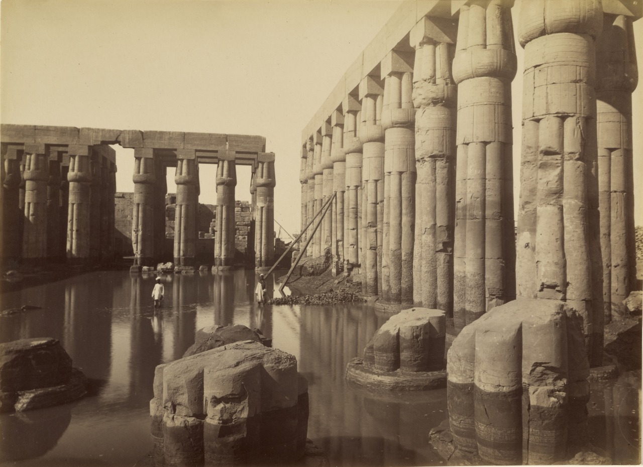
An 1875 photo by Beato of the flooded courtyard of Amenhotep III in the Luxor Temple shows you why static maps can be deceptive and show little of the actual seasonal conditions:

An 1871 photo by Beato, probably of the Luxor Temple, shows the Nile at a low point and limited building development on the east in this area.
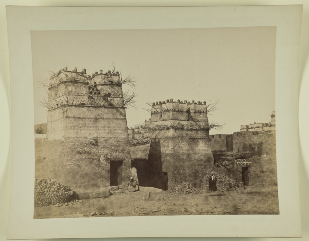
To add a bit more confusion here is another photo from Beato – (attribution dates for this photo vary wildly but around 1880) apparently of a village on the East Bank – which illustrates that the traditional housing was very distinctive in design and that the canals on the maps might have been less engineered/man made than you would think:

Another photograph by an unknown photographer from 1865-75 of an Upper Egyptian house in an unknown village shows detail of the similar and now discontinued traditional architectural style:
A fuzzy 1888 UK map of the Karnak Temple has the Avenue of the Sphinxes connecting the Karnak and Luxor Temples - which is unexpected. I thought that until Governor Farag they barely existed. The map is a bit odd with a very strange Nile shoreline and creeks on the east bank. There is little other info in the map.

The city may look ‘developed’ on a map but here is a photograph by Beato from sometime around 1860’s -70’s which shows the area around the Luxor Temple (or is it Karnak- I think it’s the former) to be not built up – note the high banks:

A rough map from a 1896 book also has the Sphinx Avenue on the East and a creek/canal on the West Bank running from the hills into the Nile and starting around Habu. There are two large islands opposite the city and Karnak and no road system shown but I don’t think this map aims to be comprehensive – I think it aims to show mainly archaeology.

A US 1905 map shows little city or agricultural development. There is one large north-south channel on the west bank which may have been for irrigation and, interestingly, a ‘modern channel’ running irregularly to the Nile from a ‘lake’ in the Birket Habu area (see above). There are islands in the Nile and very different West bank perimeters than today – but more of that later. The city looks small and compact.

Unlike modern Egyptian tourism the entrepreneurs in the 19th century tried to match good architecture with traditional themes – rather than go for the Las Vegas/Louis Farouk style. Here is Grande Pension de famille à Louxor ; circa 1906. It used to be located about 100 metres from the Nile just north of the ‘English Church’ and is a good example of how even humble 3 star businesses used to be well designed. But not nowadays.

By 1908, after the First Dam, quite a few large Islands still existed (possibly for only part of the year but I can’t be certain), the city was still small and compact north of the Winter Palace area and major canals existed on both banks. In particular a canal existed on the east bank which ran between the river bank and the Karnak Temple – its no longer there. As far as I can guess a lot of what is now the river bank on the west side was then either under water or an island – but its hard to tell. Here is the German 1908 map possibly made by Friedrich Kayser und Ernst Roloff.

If I interpret the map correctly there were structures on at least one island but whether these were permanent or only during the low water period I don’t know. An east-west canal ran inland towards Birket Habu but I don’t know whether its still these. Clearly as far as canals are concerned someone had done a lot of work. Whether the work was done by the large landholders – many of who seem to have been rich Copts, or as part of the not well studied Jewish Cassell/Mountbatten land/dam/farming ‘adventure’ isn’t clear nor whether they had a long history or were just a recent development.
Its also unclear to what extent the central government did such works or just left it to the local magnates – I think the latter. What is certain is that after 1952 the big landowners were driven out and I assume their records ‘lost’ so we will never know much of this period.
There is more of the later period but I will post another time.Note that few if any of the historic photgraphs are held in Egypt and if the Supreme Antiques have map holdings they keep quiet about them/can't interpret them/can't preserve them.